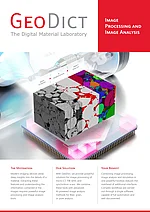
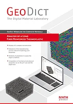
GeoDict provides a complete toolkit for 3D image processing, segmentation, visualization, and 3D-Bildanalyse of material microstructures. Import image data from CT and micro-CT (µCT), synchrotron CT, FIB-SEM, and other 2D or 3D imaging techniques, then process the data directly in GeoDict to prepare it for reliable quantitative analysis.
With ImportGeo-Vol, 3D images and 2D image stacks can be filtered, corrected, and segmented within a single environment. Powerful image-processing tools help reduce noise, enhance structural features, and remove image artifacts. A wide range of segmentation methods is available, from manual and automatic thresholding (Otsu and K-means) to multiphase segmentation, watershed methods, and advanced AI-based image segmentation, using machine learning and neural network models with a simple labeling and training framework.
With the additional GeoDict-AI module for expert users, even more advanced neural networks can be trained and applied to challenging datasets where image enhancement is a priority or where conventional segmentation methods reach their limits.
The result is a segmented, quantitative 3D representation of the actual material in which pores, particles, grains, fibers, cracks, material phases, and other structural features can be identified and measured. Instead of switching between multiple software packages, users can proceed directly from image import and segmentation to 3D image analysis, visualization, reporting, and automation.
GeoDict is designed not only for individual datasets, but also for reproducible and repeatable analysis workflows. Processing and analysis steps can be automated and applied consistently to large numbers of samples, helping research, quality control, and industrial R&D teams obtain comparable results while reducing manual effort.

Competitively priced entry package for processing 3D image data: Read more
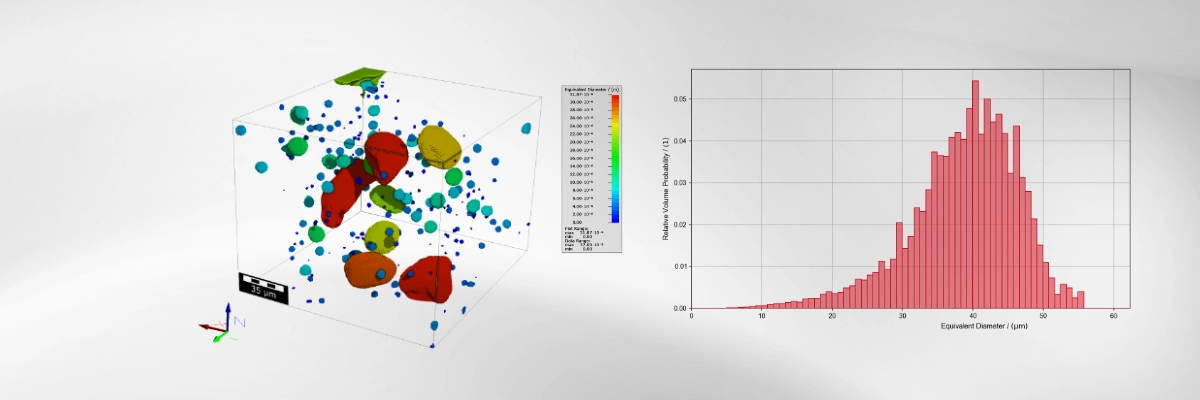
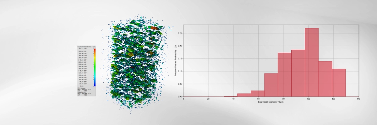
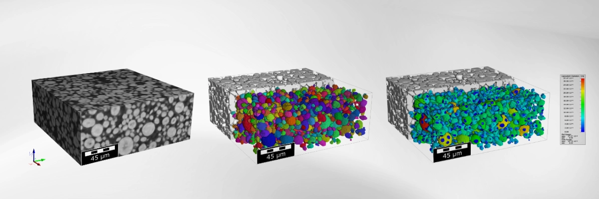
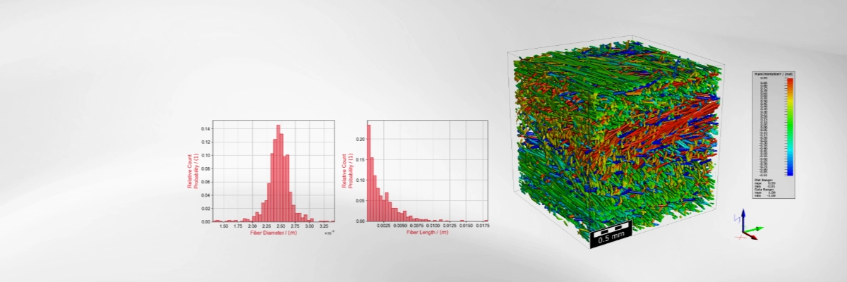
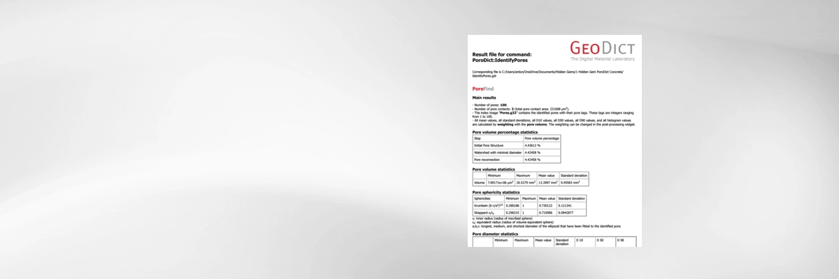
Turn segmented 3D image data into reliable, reproducible quantitative information about your material. GeoDict combines general-purpose measurement tools with specialized algorithms developed for porous, granular, fibrous and multiphase microstructures. Researchers and engineers can characterize complex materials directly from CT, micro-CT (µCT), FIB-SEM and other 3D datasets and transform image data into meaningful engineering measurements.
Depending on the application, GeoDict can be used to quantify properties such as:
Determine total, open and closed porosity and identify individual pores using specialized separation algorithms. Quantify pore volume, volume-equivalent and inscribed-sphere diameters, pore size distributions, surface area, surface-to-volume ratio, aspect ratio, sphericity, orientation, contact area and other shape parameters. Statistical distributions can be evaluated by pore number, volume or surface area and visualized directly in 3D.
Separate touching or connected objects and quantify individual grain or particle size, particle size distribution, volume, surface area, surface-to-volume ratio, sphericity, aspect ratio, orientation and spatial distribution. Specialized GrainFind algorithms combine object separation and reconnection with best-fit representations such as ellipsoids, boxes or short fibers for detailed statistical characterization.
Identify and separate individual fibers using dedicated image-processing or AI-based methods. Determine fiber diameter and length distributions, orientation distributions and orientation tensors, curvature and curliness, and visualize spatially resolved fiber orientations. AI-based methods can additionally distinguish fibers from binder where conventional gray-value segmentation is insufficient.
Analyze connected components, surface and specific surface area, solid-size distributions, percolation paths, chord-length distributions, 2-point correlation functions and other statistical descriptors. Advanced characterization using Minkowski parameters provides quantitative information about volume, surface area, curvature and topology of complex microstructures.
GeoDict provides dedicated modules for the different stages and types of 3D image processing and quantitative image analysis. ImportGeo-Vol imports, processes and segments 2D and 3D image data; GeoDict-AI enables users to train, validate and apply neural networks for challenging image-enhancement and segmentation tasks; PoroDict provides detailed characterization of separated and connected pore structures; MatDict quantifies geometric and statistical material properties; GrainFind identifies, separates and analyzes grains, particles and granular structures; and FiberFind identifies and quantitatively characterizes individual fibers and fibrous structures. ImportGeo-CAD, MeshGeo and ExportGeo-CAD extend the workflow with surface-mesh import, processing and export.
A particular strength of GrainFind and FiberFind is their ability to go beyond conventional phase segmentation. Dedicated algorithms identify and separate individual objects even when neighboring grains or fibers are connected in the segmented 3D image. GrainFind uses specialized grain-separation and reconnection methods, while FiberFind provides both classical image-processing and AI-based approaches for individual fiber identification. Practical default settings make common analyses straightforward to set up, while detailed parameters remain accessible when workflows need to be optimized for a specific material or dataset.
Particularly strong GeoDict capabilities for 3D image analysis include:
- Extensive pore characterization beyond simple porosity, combining individual-pore statistics, geometric pore size analysis, virtual porosimetry, pore-throat characterization, bubble point, connectivity, percolation paths and tortuosity within one software environment.
- Specialized grain, particle and powder analysis, including separation of touching objects, detailed shape and size statistics, fitted object representations, spatial orientation and statistical distributions.
- Advanced fiber identification and analysis, including AI-assisted individual-fiber and binder separation together with fiber diameter, length, orientation, curvature and curliness distributions.
- Detailed material morphology and heterogeneity analysis, including local thickness, volume fractions, surface area, connectivity, 2D and 3D spatial statistics, Minkowski parameters and correlation functions.
- Integrated quantitative results and professional visualization, with numerical values, statistical distributions, plots and color-coded 2D and 3D result representations available directly within GeoDict.
- Reproducible and automated image-analysis workflows using the Session Macro and the integrated GeoPy Python interface. Analysis steps are automatically recorded and can be saved, edited, shared and applied repeatedly to similar datasets, making standardized high-throughput analysis possible.
GeoDict combines these specialized material-analysis methods in one flexible, professional engineering software environment. Users can move seamlessly from the original 3D scan through segmentation to quantitative measurements, statistical analysis, 2D and 3D visualization, reporting and automated workflows without transferring data between multiple software packages.
Analysis results are presented in the GeoDict Result Viewer and can be saved as standardized PDF reports, while plots and numerical results can be exported for further documentation and evaluation. The Session Macro automatically records processing and analysis steps, making workflows easy to reproduce and share. For more advanced requirements, the integrated GeoPy Python interface provides programmatic access to GeoDict commands, structures and results and enables customized automation, batch processing, data evaluation and report generation.
This integrated approach makes GeoDict particularly suitable for materials research, product development, industrial CT and micro-CT laboratories, non-destructive testing, quality assurance, failure analysis and industrial R&D laboratories. And when questions extend beyond geometrical image analysis, the same segmented 3D microstructure can be used directly with additional GeoDict modules for property prediction and multiphysics simulation, without rebuilding or transferring the model to another software environment.