Work with GeoDict Results
As soon as the structure generation is finished, the GeoDict Result Viewer appears. Every structure generation and simulation in GeoDict creates a GeoDict result file (*.gdr) and saves it in the current project folder. This GDR file is automatically loaded into a Result Viewer at the end of the generation or simulation.
For more detailed information about the Result Viewer see the corresponding user guide.
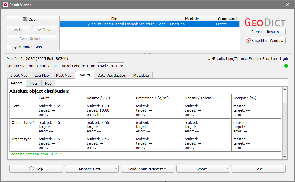
- The default tab when the Result Viewer opens is the Report subtab of the Results tab.
Here, we find information on two object types, since the fiber microstructure generated with the default values in FiberGeo contains fibers of two different types. The structure contains 432 objects, 226 of type 1 and 205 of type 2.
Observe that the defined stopping criterion is reached with an error of 0.19%. Here, the defined stopping criterion was the solid volume percentage. The default value in FiberGeo is a solid volume percentage of 10, that is 90% porosity.
- Additionally, a result folder is created in the project folder. While the result file contains all the information about the GeoDict run, the result folder contains all corresponding files. It is accessed by right click on the result file name in the header section of the Result Viewer and selecting Open Result Folder.
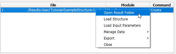
The result folder opens, and (in this case) contains only a single file: the structure file Structure.gdt of the generated microstructure in the GeoDict structure file format (*.gdt). - Close the Result Viewer by clicking Close.
|
GeoDict File Formats GeoDict provides different file formats for structures. The GDT format contains the voxel grid and the analytical information (e.g. orientation, position) of the structure. This file format is used by default in most modules in GeoDict. The GAD format contains only the analytical information of the structure and not the discretization in the voxel grid. The most common file formats in GeoDict are: *.gdt – GeoDict compressed filePreferred file format to store and load structures in GeoDict. Save through File → Save Structure as… in the menu bar. *.gad – GeoDict analytic dataFile format to store material models with analytic data. Save through File → Save Structure as… in the menu bar. See the GadGeo User Guide. *.gdr – GeoDict result fileCreated during structure generation and the run of the solvers by all property predictors. Contains generation statistics and all solver results. *.gps - GeoDict project settings fileStore the entries set in an option or parameter Edit dialog in the GUI by clicking the saving icon at the bottom of the corresponding dialog. *.py - GeoPy fileStores all parameters and settings recorded during GeoDict processes. Record a .py macro through Macro → Start Macro Recording… in the menu bar. GUF – GeoDict universal fileContains ASCII header followed by binary data. GUF is designed to contain all information on 3D images in a single file. Instances are saved by their own suffix and not found as .guf. Examples are .vap (velocity and pressure file), .das (displacement and stresses file), .gof (GeoDict orientation file, object orientation and position), .grw (GeoDict raw file, for gray-value images), .gpt (GeoDict particle trajectory), or .gpp (GeoDict particle position). |
